
The hurricane turned tropical storm, which is now a tropical depression, has resulted in 18 deaths, up to 40 inches of rain in some spots, trapped hundreds, knocked out power to more than a half-million homes and businesses and made hundreds of roads in North and South Carolina impassable.
The sprawling storm, which made landfall on Friday, is now headed our way, with parts of it now over six states.
As Florence heads north and east, it will be moving at a faster pace, but there is still the potential for 4-6 inches of rain in parts of Pennsylvania and New York, mainly upstate.
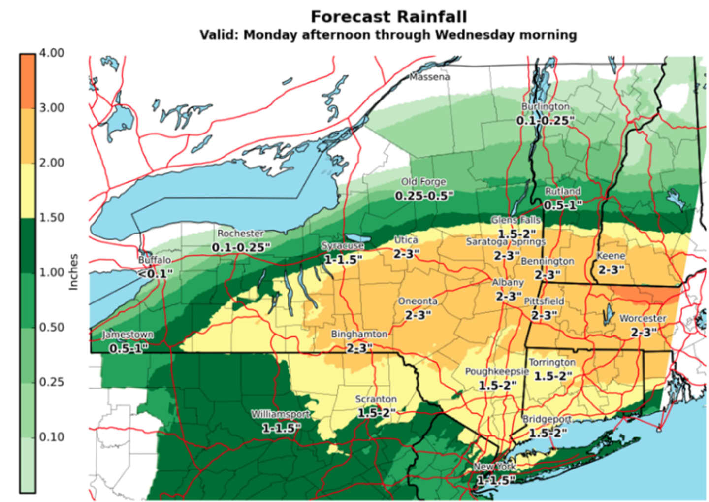
A look at projected rainfall amounts through Wednesday morning appears in the first image above.
A Flash Flood Watch is in effect for much of upstate New York (including Dutchess) and upstate Connecticut from midnight Tuesday until 2 a.m. Wednesday. (See second image above.)
The National Weather Service is currently forecasting between 1 and 2 inches for this region, with locally higher amounts from Monday afternoon into Tuesday evening.
While the most likely possibility is minor flooding from any heavy rainfall, there is still a low chance for mainly localized flash flooding, the National Weather Service said in a Hazardous Weather Statement.
Monday will be mostly cloudy with a high in the upper-70s and showers arriving sometime after 2 p.m.
Showers will continue overnight with thunderstorms possible. Some of the storms could produce heavy rainfall.
The showers and storms will continue through the day Tuesday, which will see a high temperature in the upper-70s. Shower activity will wrap up by around 11 p.m. Tuesday.
Wednesday will be sunny and pleasant with a high in the mid-70s.
Check back to Daily Voice for updates.
Click here to follow Daily Voice Pleasantville and receive free news updates.