The mixed bag of precipitation began shortly after 3 p.m., with most parts of the area seeing steady snow.
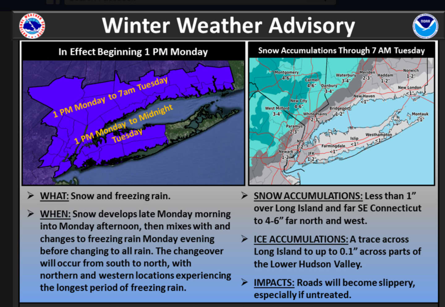
A Winter Weather Advisory is in effect until 7 a.m. Tuesday, according to the National Weather Service.
Approximately 2 to 4 inches of snow accumulation is possible for most of Northern Westchester, Putnam and Rockland. Parts of Rockland, extreme Northwest Westchester and Putnam could get 4 to 6 inches of snow. (Click on the image above for projected snow accumulation totals.)
Snow, sleet and freezing rain will continue into the early hours of Tuesday morning, followed by the changeover to rain as temperatures rise, according to the National Weather Service.
Temperatures should be around 40 degrees by 6 a.m. Tuesday.
The high on Tuesday will be near 50, with heavy rain. A total of 1 to 2 inches of rain is possible with some parts of the area seeing flash flooding, especially along the coast.
Check back to Daily Voice for updates.
Click here to follow Daily Voice Pleasantville and receive free news updates.