The timeframe for potential snowfall is overnight through around noon on Monday, Jan. 3.
"It may be hard to believe that any snow is on the way, given the warmth and lack of wintry weather thus far this season," AccuWeather Meteorologist Ryan Adamson said.
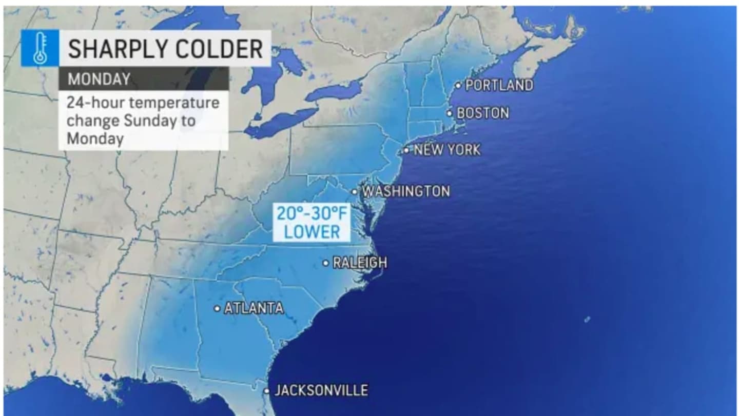
It will become sharply colder as the day progresses on Sunday, Jan. 2, from a high temperature of around 50 degrees falling into the mid 20s after nightfall. Strong winds with sustained speeds of 10 to 15 miles per hour and gusts as high as around 25 mph will make it feel even colder.
After the storm pushes through, skies will become partly sunny Monday. The high temperature will struggle to pass the 30-degree mark and wind-chill values between 15 and 20 degrees.
Tuesday, Jan. 4 will be sunny with a high in the low to mid 30s.
Check back to Daily Voice for updates.
Click here to follow Daily Voice Hampden and receive free news updates.