

An Arctic cold front will trigger a massive new winter storm that will deliver a one-two punch of rain and damaging winds for the entire region with heavy snow farther north and inland.
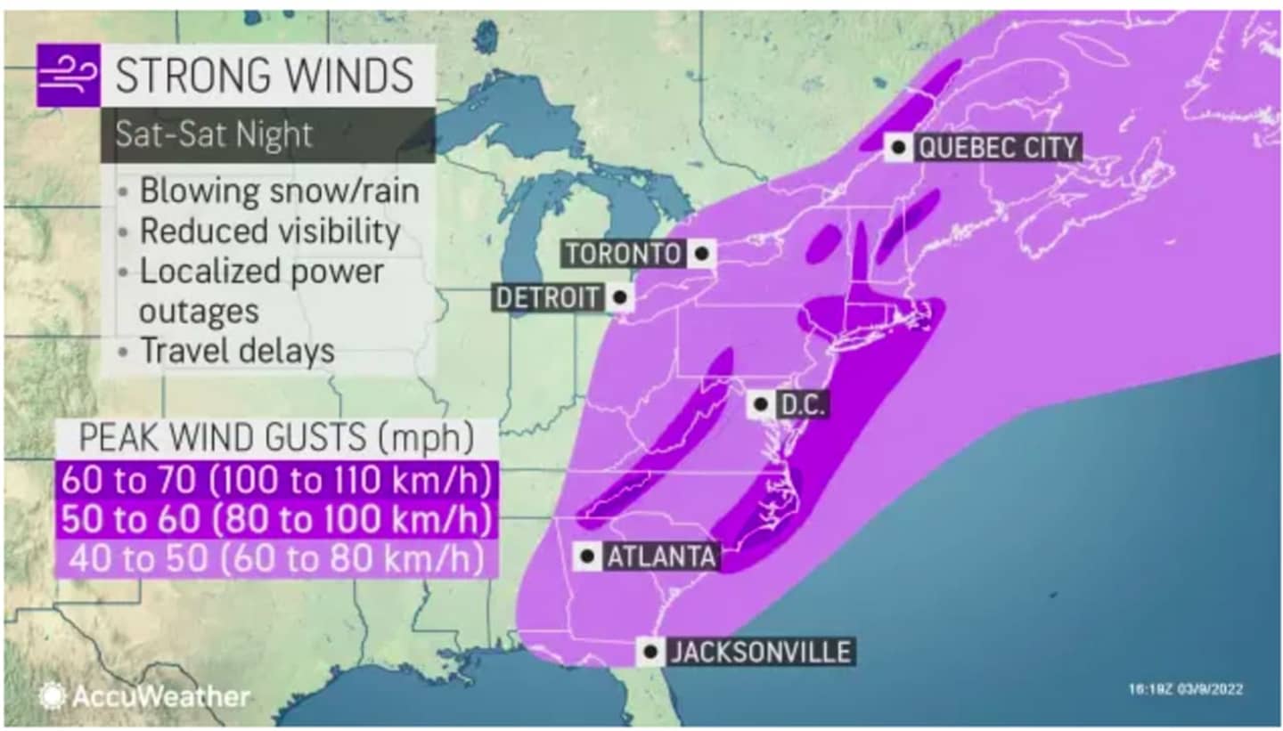
Wind gusts between 40 and 70 miles per hour are expected on Saturday, March 12 during the height of the storm during the afternoon and evening, according to AccuWeather Meteorologist Alex DaSilva, who added that power outages could be widespread.
The two days leading up to the storm will be dry and seasonable, with partly cloudy skies on Thursday, Mach 10 and Friday, Mach 11 with a high temperature in the upper 40s both days, according to the National Weather Service.
The storm system will move into the region in the early morning hours on Saturday.
- For a look at areas where wind gusts between 40 and 70 miles per hour are possible, see the first image above.
- Click on the second image above for projected snowfall amounts, with 12 to 18 inches of accumulation (shown in blue) possible in upstate New York and northern New England.
- Click on the third image above for a look at precipitation types for the storm.
The powerful system will wind down just as it's time to "Spring Forward" with the start of Daylight Saving Time at 2 a.m. Sunday, March 13 when clocks are changed ahead one hour.
Check back to Daily Voice for updates,
Click here to follow Daily Voice Pleasantville and receive free news updates.